 Isaiminia World Breaking News & Top Stories
Capturing detailed 3D spatial data remains one of the most persistent challenges engineers face across disciplines. Whether documenting complex infrastructure, mapping terrain for construction projects, or creating digital twins of industrial facilities, the quality of spatial understanding depends entirely on the density and accuracy of the data collected. Sparse or incomplete point clouds lead to costly errors, rework, and compromised project outcomes. The Galois P4 laser scanner represents a significant leap forward in LiDAR technology, engineered specifically to deliver the high-density point clouds that modern engineering workflows demand. This article explores how the Galois P4 enables engineers to achieve unprecedented point cloud density for precise spatial understanding, covering everything from the technology’s core capabilities to practical implementation strategies. Whether you work in surveying, construction, infrastructure inspection, or industrial automation, the insights here will help you leverage advanced LiDAR scanning to elevate your data collection and analysis processes.
Understanding High-Density Point Clouds and Their Critical Role
A high-density point cloud is a collection of millions—sometimes billions—of precisely georeferenced data points that together form a comprehensive three-dimensional representation of physical space. Unlike sparse datasets that capture only prominent features, high-density point clouds record surfaces, edges, and geometric details at sub-centimeter intervals, creating 3D spatial data rich enough to support critical engineering decisions. This level of spatial understanding transforms how teams approach design validation, clash detection, and as-built documentation. Traditional survey methods—total stations, manual measurements, even photogrammetry—struggle to match this resolution. They introduce gaps, require interpolation, and often demand multiple site visits to capture what a single high-density scan achieves in minutes. These gaps translate directly into risk: missed conflicts in building systems, inaccurate volume calculations, or structural assessments built on incomplete geometry. For engineers working at the intersection of precision and efficiency, high-density point clouds eliminate guesswork. They provide a faithful digital replica of reality where every measurement is verifiable, every surface is documented, and spatial understanding extends from macro-scale site context down to individual bolt patterns and weld seams.
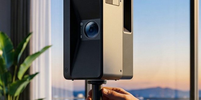
Introducing the Galois P4: Advanced LiDAR Scanner Technology
The Galois P4 LiDAR scanner was developed to address a fundamental gap in the market: engineers needed a single instrument capable of producing exceptionally dense point clouds without sacrificing field efficiency or data accuracy. Where standard point cloud laser scanners force compromises between scan speed and resolution, the Galois P4 delivers both simultaneously, generating millions of measurement points per second while maintaining millimeter-level positional accuracy across its full operational range. This capability means engineers can capture complete environments—from sprawling industrial plants to confined mechanical rooms—with the confidence that no critical geometric detail will be lost in the dataset. The system integrates seamlessly into established engineering workflows, outputting industry-standard file formats compatible with major processing platforms. For engineers who have struggled with stitching together incomplete scans or revisiting sites to fill data gaps, the Galois P4 represents a fundamentally different approach to spatial data collection—one where a single scanning session yields point clouds dense enough to support every downstream analysis requirement.

Core Features of Galois P4 for Enhanced Performance
The Galois P4 achieves its high-density point cloud output through several integrated technologies working in concert. Its laser emission system operates at an elevated pulse repetition rate, dramatically increasing the number of measurement points captured per scan pass. An advanced beam-steering mechanism provides uniform point distribution across the entire field of view, eliminating the coverage gaps common in conventional LiDAR scanners. The scanner’s extended effective range maintains point density even at distance, ensuring that far-field surfaces receive the same detailed treatment as near-field objects. Combined with real-time waveform processing that filters noise at the hardware level, these features produce clean, dense datasets ready for immediate engineering use.
Step-by-Step Guide to Achieving High-Density Point Clouds with Galois P4
Achieving optimal point cloud density with the Galois P4 requires more than simply powering on the device and pressing scan. Engineers who consistently produce the highest-quality datasets follow a deliberate workflow that maximizes the scanner’s capabilities while minimizing common data collection pitfalls.
Begin with thorough pre-scan planning and environment assessment. Walk the site to identify potential obstructions, reflective surfaces, and areas requiring overlapping scan coverage. Determine scan station positions that ensure line-of-sight to all critical surfaces, and establish control points for registration accuracy. This upfront investment in planning eliminates the need for return visits and ensures complete spatial coverage from the first session.
Next, configure the Galois P4 settings for optimal density based on your project requirements. Adjust the angular resolution to match the level of geometric detail needed—tighter angular increments for complex mechanical assemblies, slightly wider spacing for broad terrain mapping. Set the pulse repetition rate to its maximum when capturing intricate environments, and configure range gating to exclude irrelevant background data that would otherwise dilute useful point density.
During data acquisition, maintain consistent scan overlap of at least thirty percent between adjacent stations. Position the scanner at varying heights when documenting vertical structures to capture undercuts and overhangs that single-elevation scans miss. Use the Galois P4’s real-time density preview to verify coverage before moving to the next station, catching gaps immediately rather than discovering them during post-processing.
Finally, process your collected data using compatible software tools that preserve the full density of the Galois P4 output. Register overlapping scans using target-based or cloud-to-cloud alignment, apply noise filtering conservatively to retain fine geometric details, and export in formats that maintain full point density for downstream engineering analysis. This systematic approach transforms raw scanner capability into reliably dense, accurate point clouds that serve every project requirement.
Applications and Benefits for Engineers in Various Fields
The high-density point clouds generated by the Galois P4 unlock transformative capabilities across engineering disciplines. In construction, project teams use dense 3D spatial data to verify as-built conditions against design models in real time, catching deviations before they cascade into costly rework. Structural engineers overlay point cloud data onto BIM models to perform precise clash detection, identifying conflicts between mechanical, electrical, and plumbing systems that would otherwise remain hidden until installation. Surveying professionals leverage the Galois P4’s output to produce topographic maps and volumetric calculations with confidence levels previously unattainable through conventional methods. The density of captured data means terrain features, drainage patterns, and grade changes are documented with centimeter-level fidelity rather than interpolated between sparse measurement points. In industrial automation and facility management, engineers create comprehensive digital twins from Galois P4 scans that support equipment placement planning, maintenance access verification, and retrofit design without repeated site visits. PropTech platforms such as Realsee have demonstrated how high-density spatial data can be transformed into immersive virtual environments for property visualization and management, illustrating the broader ecosystem that benefits from precise 3D capture. Infrastructure inspection teams benefit from the ability to detect subtle surface deformations, crack propagation, and structural displacement by comparing sequential high-density scans over time. This spatial understanding enables condition-based maintenance decisions grounded in measured geometric change rather than visual estimation. Across every application, the common thread is efficiency paired with precision—engineers spend less time collecting data and more time acting on reliable spatial intelligence.
Comparing Galois P4 with Other LiDAR Scanners in the Market
When engineers evaluate LiDAR scanners for high-density point cloud production, several performance metrics determine whether a system meets project demands or introduces limitations that compromise results. The Galois P4 distinguishes itself in this competitive landscape through measurable advantages in the areas that matter most to practicing professionals.
Point density output represents the most fundamental differentiator. Many conventional LiDAR scanners on the market achieve adequate density only at close range, with measurement spacing degrading significantly beyond midfield distances. The Galois P4 maintains consistent point spacing across its full operational envelope, meaning engineers receive uniform data quality regardless of whether they are scanning a nearby pipe rack or a distant building facade. This eliminates the common workaround of establishing additional scan stations solely to compensate for density falloff—saving field time while improving dataset homogeneity.
Scanning speed presents another critical comparison point. Some competing systems achieve high density only by dramatically slowing their acquisition rate, turning what should be a rapid field operation into an hours-long process. The Galois P4’s elevated pulse repetition rate delivers dense coverage at acquisition speeds that keep projects on schedule, a practical advantage that compounds across multi-day scanning campaigns involving dozens or hundreds of stations.
Data quality straight from the scanner also sets the Galois P4 apart. Where many LiDAR scanners produce noisy raw data requiring aggressive post-processing filters—filters that inevitably remove legitimate geometric detail along with noise—the Galois P4’s hardware-level waveform processing delivers cleaner initial datasets. Engineers retain more true surface information through their processing pipeline, resulting in high-density point clouds that faithfully represent real-world conditions. For teams making critical infrastructure decisions based on scanned data, this fidelity difference translates directly into confidence and reduced professional risk.
Elevating Engineering Workflows with Galois P4 High-Density LiDAR
The Galois P4 laser scanner fundamentally changes what engineers can expect from field-based spatial data collection. By delivering high-density point clouds with consistent quality across its full operational range, it eliminates the compromises that have long plagued LiDAR workflows—trading speed for resolution, accepting density falloff at distance, or tolerating noisy data that obscures the geometric truth engineers need. From pre-scan planning through post-processing, the system rewards deliberate methodology with datasets dense enough to support clash detection, structural assessment, volumetric analysis, and digital twin creation without return visits or data gaps. Engineers across construction, surveying, infrastructure inspection, and industrial automation gain not just better 3D spatial data, but deeper spatial understanding that drives confident decision-making. As LiDAR technology continues advancing toward faster acquisition rates, greater range performance, and tighter integration with AI-driven analysis platforms, the Galois P4 positions engineering teams at the forefront of this evolution—equipped today with the point cloud density that tomorrow’s workflows will demand as standard.